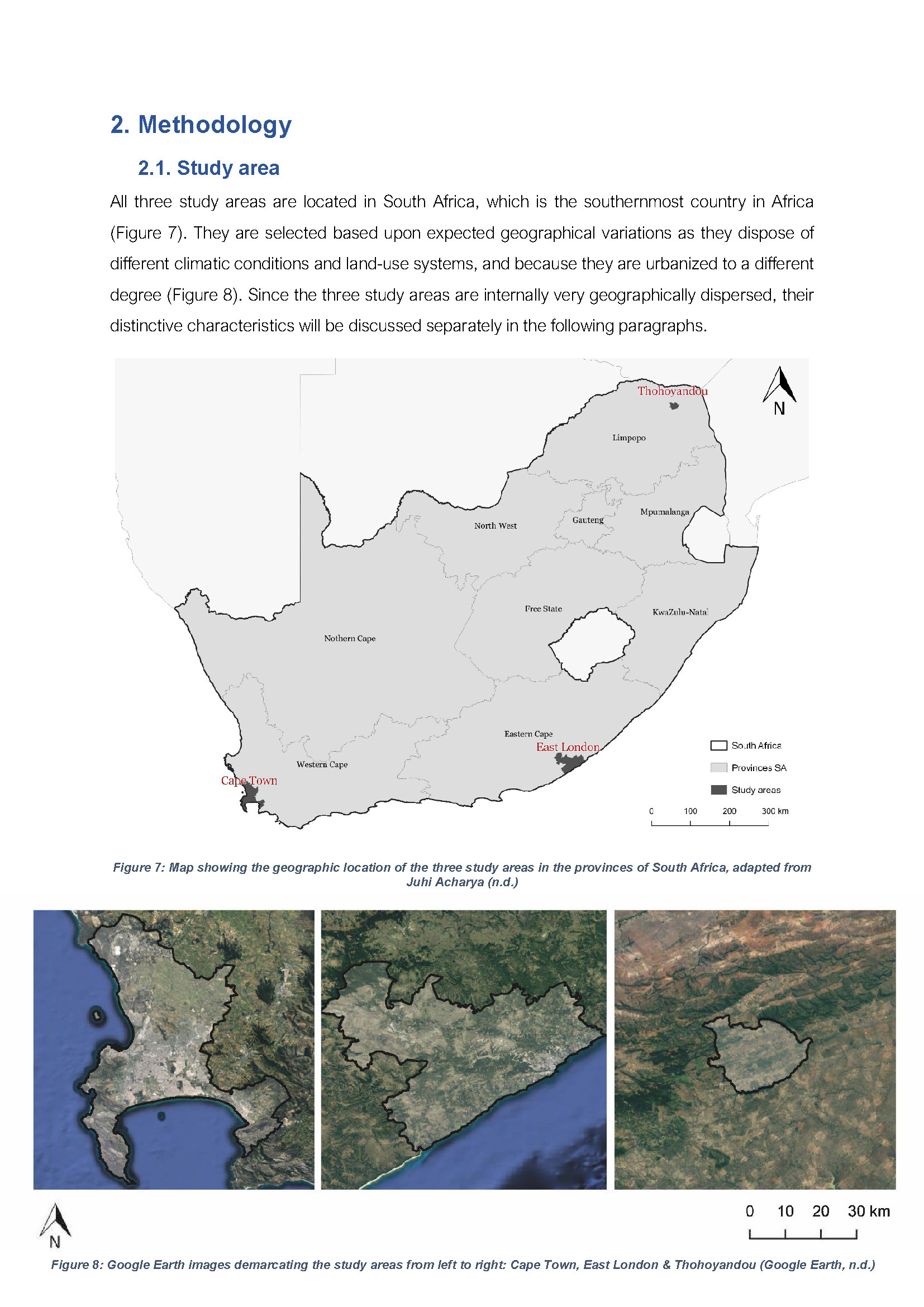
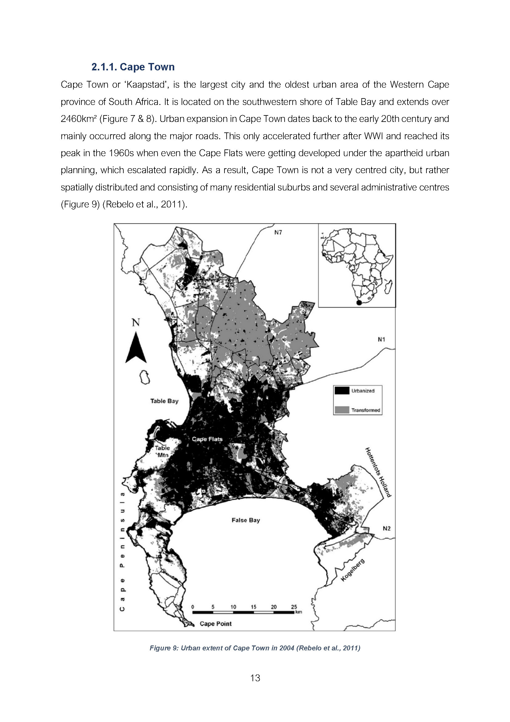
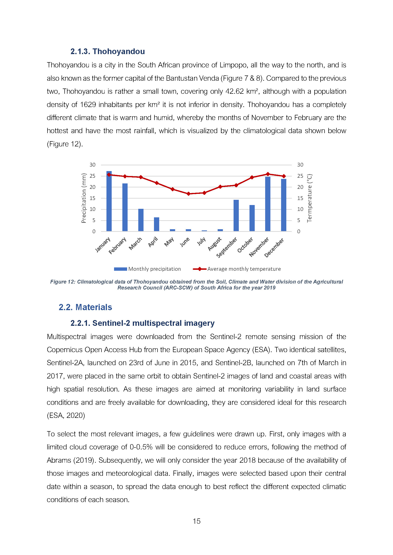
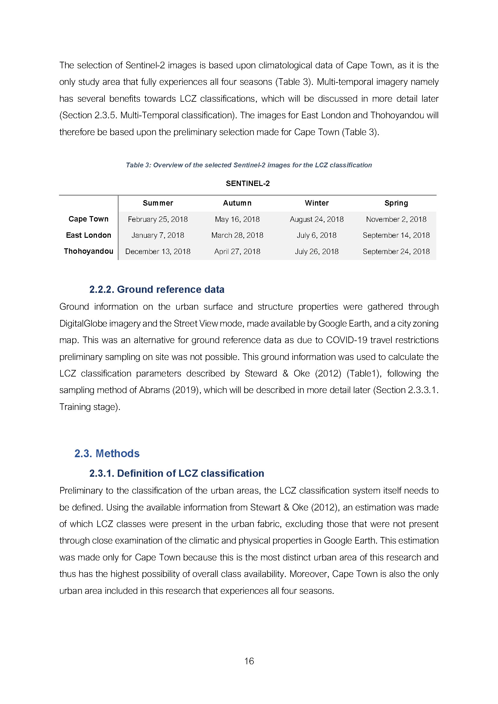
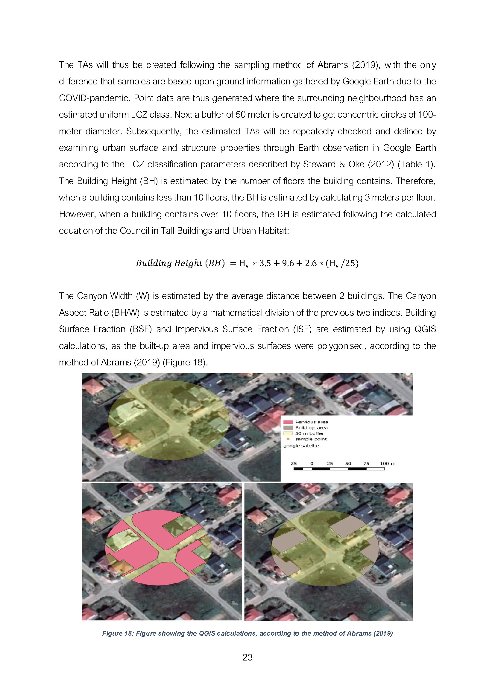
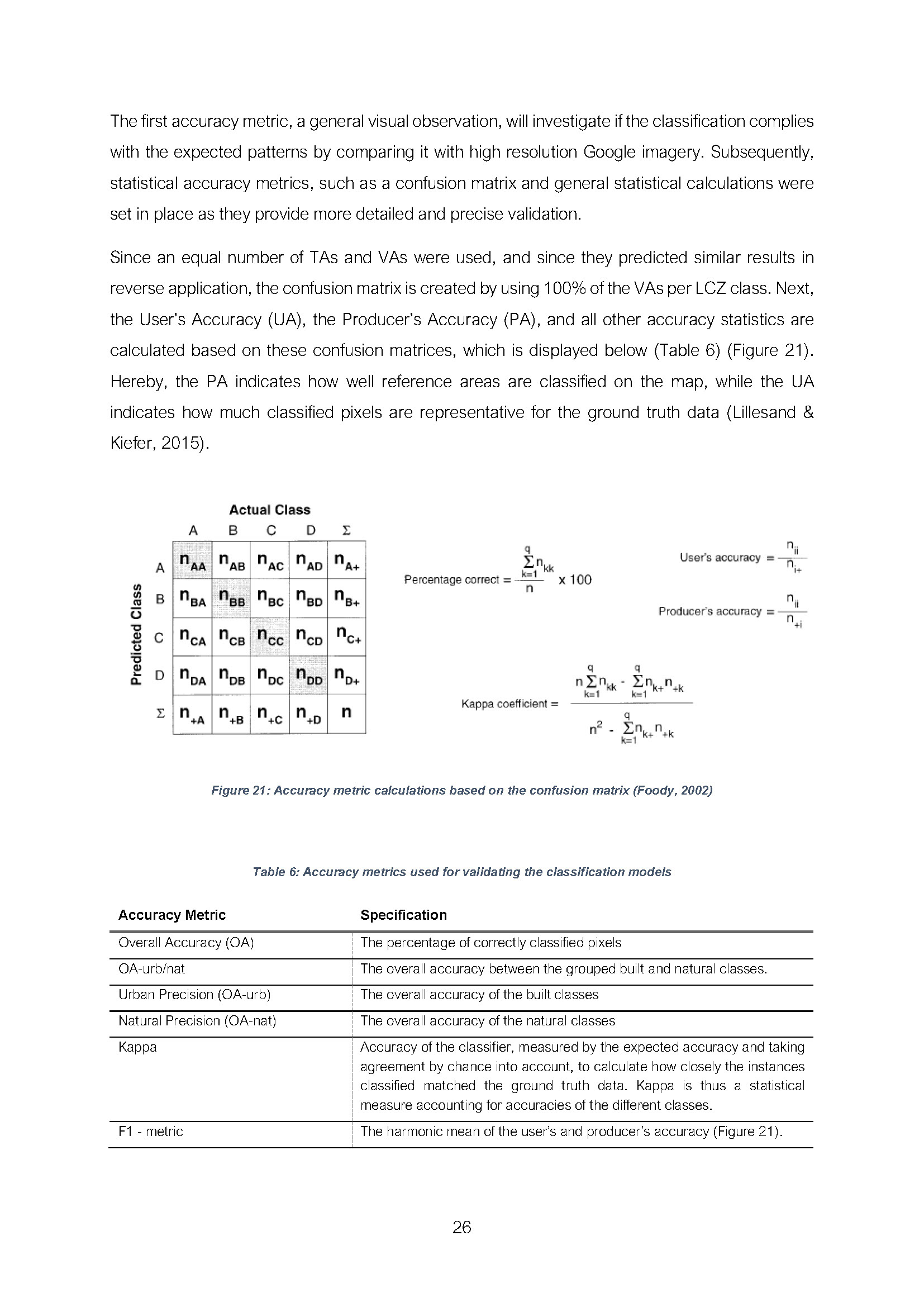
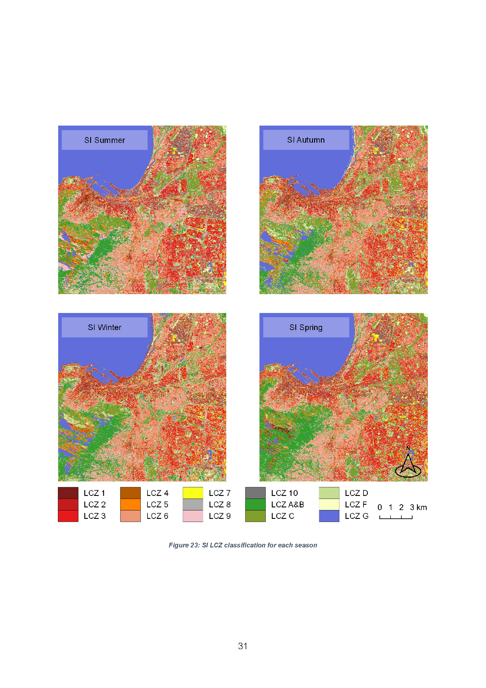
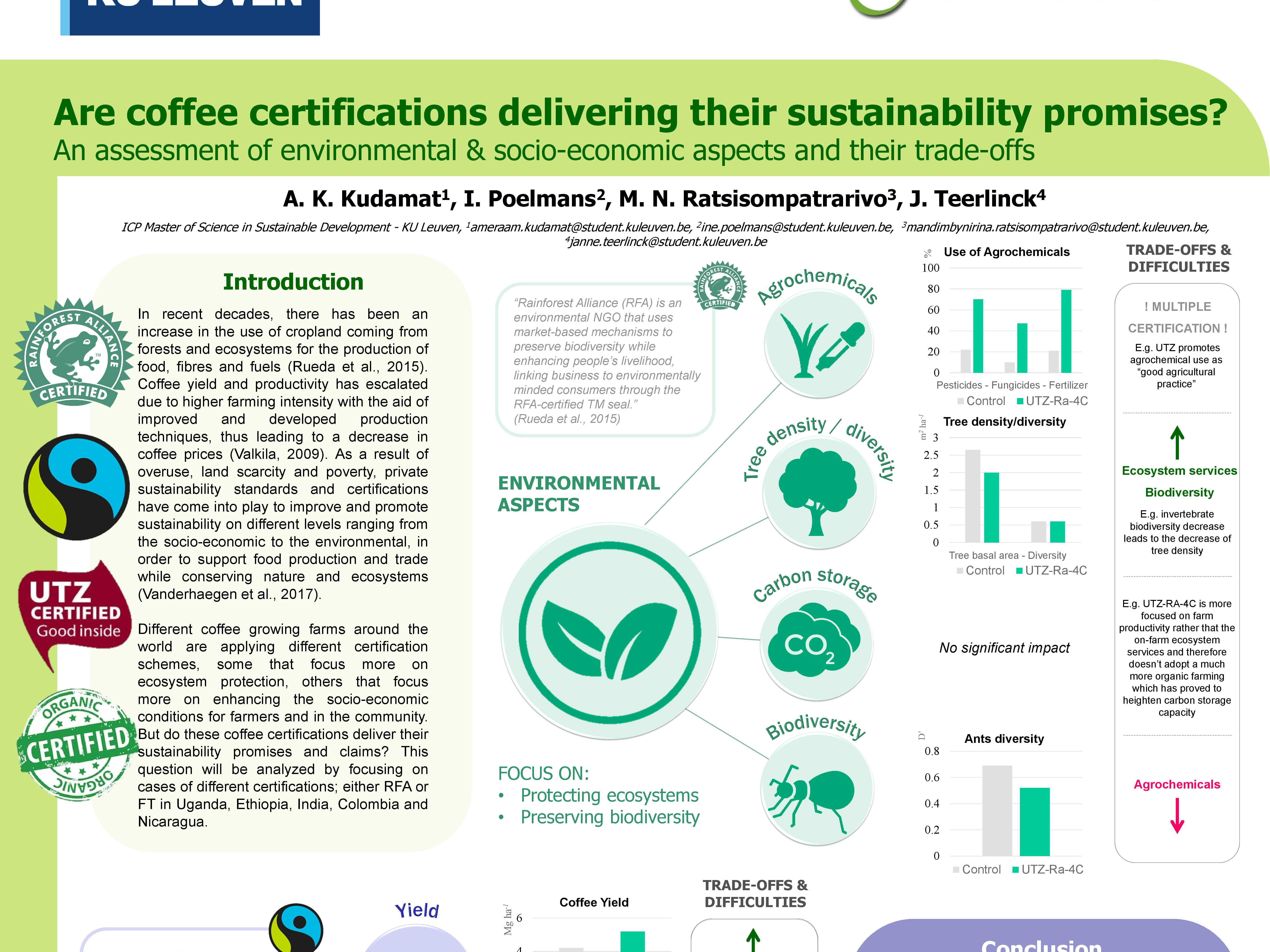
The increasing rate of urbanization and population growth continues to alter the natural landscape and impact its surface conditions. This creates distinct climatic conditions and Urban Heat Islands which leads to increased environmental problems and a reduced quality of life in urban areas. At the same time, urban areas will have to play a significant role in coping with the current climate crisis. Therefore, monitoring of the spatial impact of urbanization is becoming increasingly important as it allows urban planners to quantify the effects on the local climate.
A globally available high-resolution database on the form and functions of cities was made available by the ‘World Urban Database and Access Portal Tools’ initiative. The WUDAPT Local Climate Zone (LCZ) classification system which delineates zonal representations of climatic conditions, however, tends to be more accurate in northern regions of the world. Therefore, this thesis aims at contributing to the development of a more generalized and universal framework. In more detail, the aim is to develop an automated LCZ classification methodology for urban areas in South Africa by investigating the influence of using satellite images of a higher resolution, of adding seasonal data, and of applying neighbourhood information, on the accuracy levels of the LCZ classification focused on mapping the urban fabric of Cape Town. In addition, it aims at testing the transferability of this adjusted methodology to other urban areas such as East London and Thohoyandou, meaning that the classification will be trained according to the methodology of the Cape Town classification, but validated by local samples.
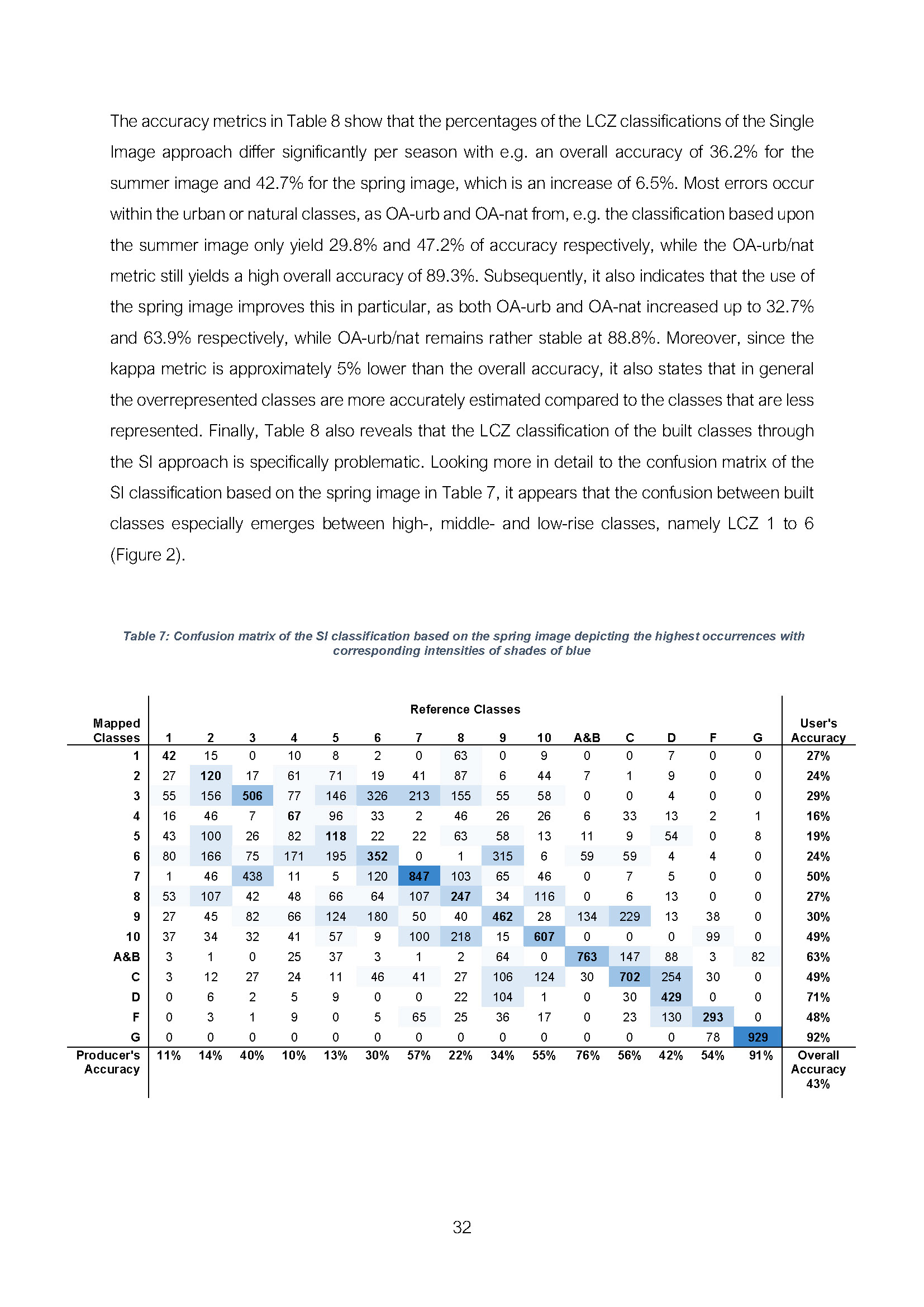
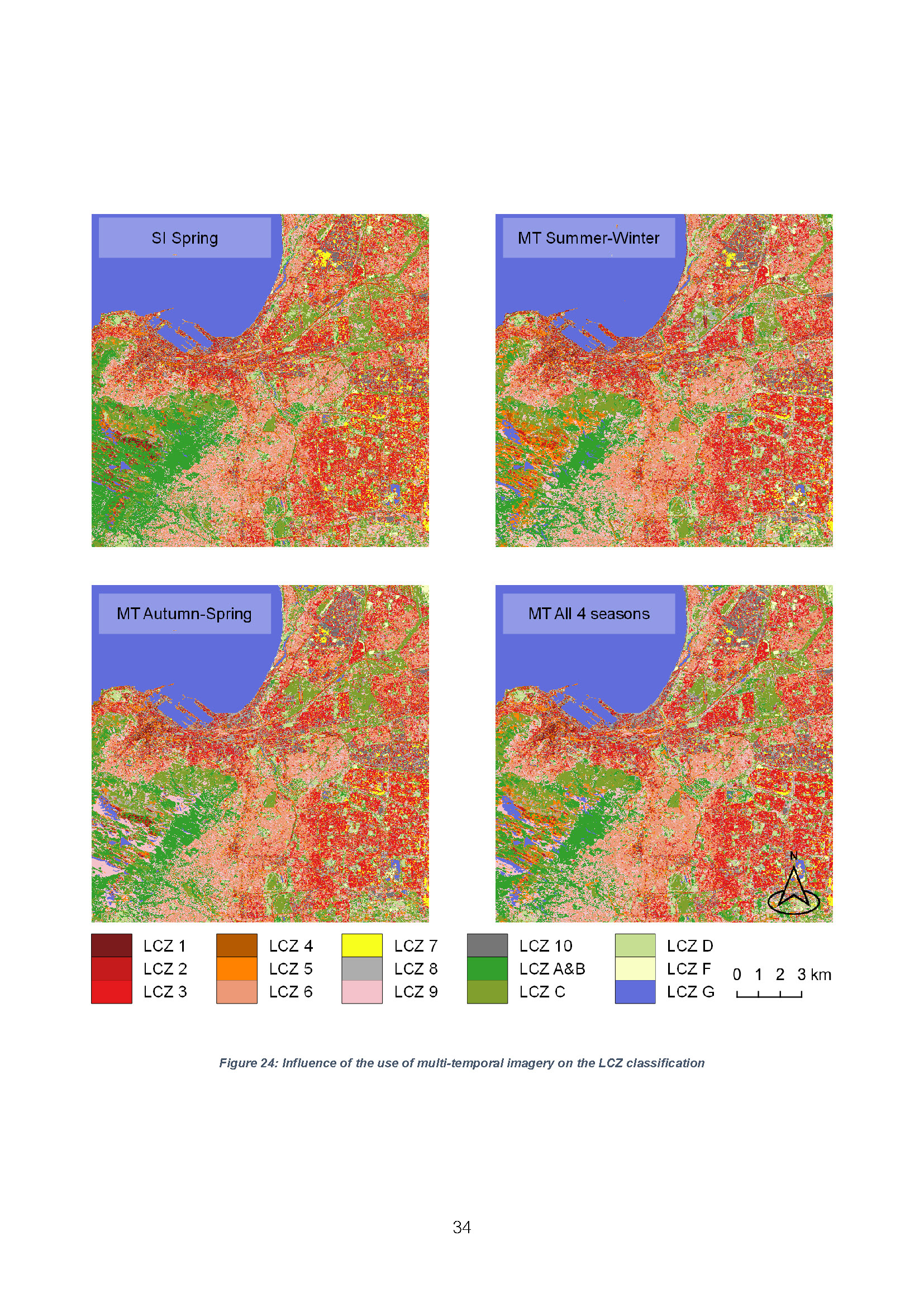
The results of this research led to the proposal of three main improvements to the generic WUDAPT LCZ framework. First, they suggest that the increased resolution of 10-meters and the reduced size of training and validation samples better reflects the spatial heterogeneity of the specific urban areas in South Africa. Secondly, the results demonstrate that it is more important to focus on selecting the best fitting seasonal imagery for the LCZ classification for Cape Town than on using additional seasonal data. Thirdly, the results show that the addition of neighbourhood information improves the classification. In addition, the results of the transferability assessment demonstrate that the use of seasonal data did bring about clear improvements in this case. Finally, this research identifies that there is a scope for further research, namely more and broader research on the use of seasonal data and neighbourhood information, including field research and local knowledge, applying additional building height data, and adding a stability analysis and gradient approach. Hereby, this research has the potential to serve as a steppingstone towards efficient urban monitoring, further helping local planners to more accurately develop and implement strategies to combat climate change.